Jerusalem City
Jerusalem
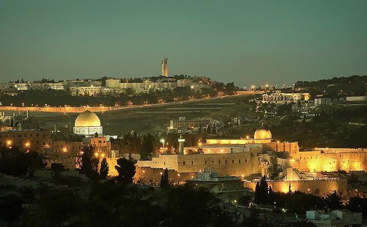
Temple Mount
When King Solomon constructed his first Temple in Jerusalem the hillside on which he did so became the most important cultic site of the monotheistic world, and is still reverenced by Jews and Muslims today. Solomon (960 - 900BCE) built the temple that David was not allowed to, using Phoenician craftsmen from the neighboring kingdom of Tyre (See the lengthy account of the process in 1 Kings). He also built a circular platform around the edge of the hill to hold the courtyards that encircled the cedar wood and bronze building, and the whole edifice was to have been the focus of Jewish worship for ever. However, after his reign the Northern Kingdom declared autonomy, after which time the Temple was used by the tribes of Judea and Benjamin only.
In 586BCE the Temple was destroyed by the Babylonians as Israelites continued to be trapped between warlike Southern and Northern empires. The inhabitants of Judea were killed or taken into exile (excepting the farmers). It was only after fifty years and the auspicious intervention of Persia, the new inheritors of imperial power, that they had the opportunity to return and rebuild the Temple, the thought of returning having sustained many of them during their exile (See Ezra and Nehemiah).
This hastily constructed Temple stood until the Hasmonaeans shored it up in 186BCE, but was pulled down by Herod the Great in 20BCE who began a brand new building that was only finished sixty years after his death. He also constructed a much larger square platform around the hill to allow the Gentiles to go there without profaning the sacred areas towards the temple itself, and it is this platform that is the "Temple Mount" to this day.
This temple was destroyed by the Romans during the Jewish revolt in AD70, just six years after its completion. The platform was, however, allowed to remain andiIt became the basis for a temple to Jupiter in the new Hadrianic city of Aelia Capitolina, surviving until the Byzantine period when the area was turned into a rubbish dump, proving visibly to the recently pagan that God had turned his favor from Jew to Gentile Christian. Such was the state when Omar the first caliph marched triumphant into the city and, having forced the Christian Patriarch to crawl on his hands and kness from the Holy Sepulchre to the Mount as penance for desecrating it, built the Dome of the Rock where the temple had stood six hundred years previously.

Temple Mount
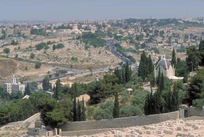
The view from the Mount of Olives is wondrous: The densely packed walled city of Jerusalem embraced by the Hinnom and Kidron valleys, the Golden Gate to Mount Moriah, the Temple Mount, Mount Zion, David’s City and more, bring alive both prophecy and Psalms. It is from the Mount of Olives, with its view not only toward the Holy City, and its green surroundings, but toward the wilderness, that one understands how Jerusalem got one of its earliest names, Zion (2 Sam. 5:7), which comes from a word meaning desert.
On the eastern slope of the Mount of Olives is Bethany, where a beautiful church marks the home of Lazarus, Mary and Martha (John 1:11), and where visitors can descend and emerge dramatically from the traditional tomb of Lazarus, whom Yeshua raised from the dead (John 11:43).
The Palm Sunday Walk, which begins at Bethphage, follows the traditional path Yeshua took in his triumphal entry to the Holy City (John 12:13-15). It stops in the quiet garden chapel of Dominus Flevit, marking the site where Yeshua wept over Jerusalem (Luke 19:41), and then passes the ancient Jewish cemetery, where the deceased await the resurrection when the Messiah comes to the Mount of Olives (Zach. 14:4). This is an important place to pause and consider that the Mount of Olives is not only a geographical link between the desert and the fertile Jerusalem hills, it is the spiritual link between death and life, also emphasized by the resurrection of Lazarus in Bethany.
In the early days of Christianity, monks came to the Mount of Olives in large numbers, seeking the solitude of its heights where they could deepen their understanding of these and other Scriptural truths.
The Palm Sunday walk culminates in the Garden of Gethsemane, one of the most dramatic sites on a Christian itinerary. This and Olivet’s other sites – the Pater Noster (“Our Father”) Church, named for the prayer Yeshua taught (Matt. 6:9-13), the Dome of the Ascension, the Tower of the Ascension and Viri Galilaei (Acts 1:11), – stir powerful emotions that make this visit an unforgettable spiritual highlight.
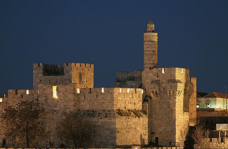
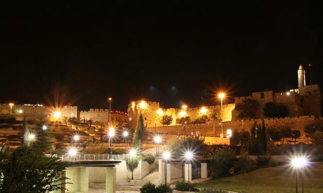
Tower of David Museum
At the Tower of David Museum, not only do the captivating exhibits deepen your understanding of Jerusalem, its very stones are part of this city’s living history. The complex housing the museum, located at the Old City’s Jaffa Gate, spans the centuries: its nearly 500-year-old walls are part of the Turkish citadel; its name derives from a tower so massive that early Jerusalemites ascribed it to their great King David (ironically its builder was actually the much-maligned King Herod); the spire standing over it became a worldwide symbol for Jerusalem after the British General Allenby marched into Jerusalem beneath its shadow in 1917.
Your visit can begin with a breathtaking view of Old and New Jerusalem from the top of the tower for which the museum is named. Then you can explore the exhibits, where videos, dioramas and computer graphics come together to illuminate the complexities of a city unique in the annals of human history. Each ancient room has been revamped to showcase a different period, allowing the tempestuous events of 4,000 years to fall perfectly into place in your mind. The windows frame glimpses of modern Jerusalem, and with each doorway you exit, you look down into the citadel’s central courtyard, where archaeologists have unearthed remains dating from the Maccabees to the Middle Ages.
The museum also utilizes its unique space for multi-sensory exhibits by leading designers and artists from Israel and abroad, and for memorable private functions.

Mount of Olives
Located east of Jerusalem’s Old City and separating it from the Judean Desert, the Mount of Olives is one of the most prominent sites in the Jerusalem vicinity mentioned in the Holy Scriptures. It is first mentioned as King David’s escape route during the rebellion of his son Absalom, then later in the prophets; but it is most often referred to in the New Testament, being the route from Jerusalem to Bethany and a favorite location for Yeshua' teachings to his pupils and where he wept over Jerusalem. Here, the Dominus Flevit Church was built by the Franciscan order in 1954 to designs by A. Barluzzi in the shape of a tear atop remains of a Byzantine church.
At the foot of the mountain, adjacent to the Church of All Nations, stand the Gardens of Gethsemane (Gat Shemanim- oil press in Hebrew), in which one finds the golden turreted Russian Orthodox Church of Maria Magdalene. Besides the compound of churches adjacent to Mount Scopus at its north, which includes the Basilica of the Sacred Heart, the Basilica Eleona and the convent of Pater Noster, it is perhaps best known for the extensive cemetery that faces Jerusalem all along its western slopes.
Believed to be the place from which Yahweh will begin to redeem the dead when the Messiah comes, Jews have always sought to be buried here. The most famous of these graves actually lie at the foot of the mountain, flush against the Old City walls, including the Tomb Of Zechariah, the tombs of the sons of Hezir and Yad Absalom. Further up, among the 150,000 graves in the Jewish cemetery, one may find the final resting places of Jewish philosopher Nahmanides, Hebrew language reviver Eliezer Ben-Yehuda, former Prime Minister Menachem Begin, Chief Rabbis Avraham Isaac Kook and Shlomo Goren and media mogul Robert Maxwell.
Presently, the Jerusalem Municipality in conjunction with the Prime Minister’s Office is embarking upon an ambitious renewal and development project for the entire site. The 100 million shekel project includes the renovation of thousands of graves destroyed during the Jordanian rule over Eastern Jerusalem between 1948 and 1967 and the development and maintenance of roads, fences and a tourist information center. The project is expected to last for five years, due to the religiously sensitive nature of the area, which inhibits the use of heavy machinery.

Garden of Gethsemane
Visitors to of the Garden of Gethsemane are amazed when they learn that the gnarled olive trees they see could have been young saplings when Yeshua came here with the disciples on that fateful night after the Last Supper (Matt. 26:36; Mark 14:32; John 18:1).
Today the ancient trees rise from manicured flower beds; in Yeshua’ time this would have been an olive grove where an olive-oil press – gethsemane in Greek – was located.
The impressive Church of All Nations, built in the 1920s over earlier churches, relates the events of this place in brilliantly detailed floor-to ceiling mosaics: Yeshua praying alone (Mark 14:35-36); Judas’ betrayal of Yeshua (Matt. 26:48); the cutting off of the ear of the High Priest’s servant (Mark 14:47).
Across the lane is a less-frequented grove, where arrangements can be made for visitors to spend a more private time of worship and contemplation.
Wailing Wall
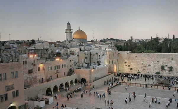
Western Wall
Visitors who stand at the Western Wall, looking up at the huge ancient stones – the last remnant of the Temple in Jerusalem – are almost always surrounded by people: some have come to celebrate a Bar Mitzvah, others to take pictures before a wedding, or to place a heartfelt prayer-note within the cracks between the stones. But they sense the presence not only of the here-and-now, but also of the untold numbers of people who for centuries streamed to this, the most sacred place in the world to the Jewish people.
The Western Wall was part of the most magnificent building Jerusalem had ever seen. It was one of four walls Herod the Great built to support the 1,555,000-square-foot plaza on which the Temple stood. It was almost 1,500 feet long – the rest can still be seen inside the Western Wall Tunnel. Originally it was some 90 feet high and reached some 60 feet into the ground.
But it is not because of its grand architecture that the Western Wall became an inseparable part of the Jewish People. Solomon, who built the First Temple, said it best with these words: “May Your eyes be open day and night toward this House, toward the place of which You have said, ‘My name shall abide there;' may You heed the prayers which Your servant will offer toward this place. And when You hear the supplications which Your servant and Your people Israel offer toward this place, give heed in Your heavenly abode...” (1 Kings 8:17).
It was Abraham who first linked the Jewish people to Jerusalem, when he offered Isaac in sacrifice on Mount Moriah, the Temple Mount, now above and behind the Wall.
The rock of the offering, over which the Dome of the Rock was built in the late seventh century, is known in Jewish tradition as the Foundation Stone of the world.
King David purchased this land; Solomon's First Temple was destroyed by the Babylonians in 586 BCE; Herod expanded the Second Temple, which was burned by the Romans in 70 CE, except legend says, for the Western Wall. It was then that Talmudic sages began to teach: "This is the Western Wall of the Temple, which is never destroyed for the shekhinah [the Divine presence] is in the west" (Bamidbar Rabah 11:63).
In the Middle Ages, the Wall received another name – the Wailing Wall, as Jews were observed here lamenting the Temple's destruction. A legend says that on Ninth of Av, the anniversary of the Temple's destruction, the dew glistening on the stones is the Wall itself shedding tears.
For 19 years, from 1948 until 1967, when Jerusalem was divided, Jews were separated from the Wall. But then, in the Six Day War, on June 7, 1967, Jerusalem was reunited. From then on, the Western Wall became not only a symbol of glories past and a place to leave a bit of oneself in the form of notes bearing prayers and blessings, but of the love and devotion of the Jewish People for their Holy City now and forever.
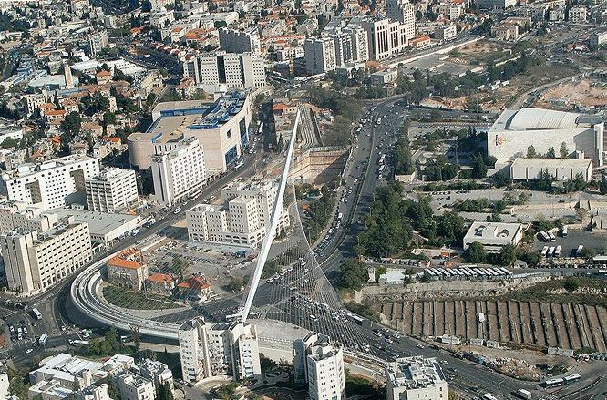
New Bridge in Jerusalem
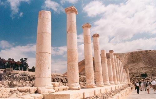
Beit Shean Colums
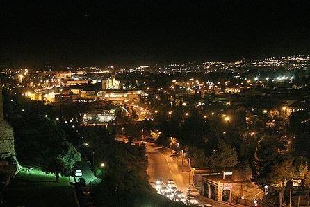
Jerusalem at night
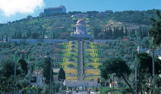
Bahai Shrine and Gardens
Beauty, grandeur, and inspired design, combined with the painstaking gardening of generations, create the unique atmosphere of the Bahai Shrine and Gardens in Haifa. This is the site where members of the Bahai faith have established their shrine and world center because of its significance to the Bahai faith.
The Bahai faith had its origins in the in Iran, where its followers severed themselves from the existing Moslem Shi’ite faith. Its founder, Baha'u'llah, was exiled from his homeland at the end of the 19th century, and came to Akko (Acre) and Haifa after suffering persecution in neighboring Moslem countries. He was impressed with the beauty of Mount Carmel and expressed the desire that the Bab, the forerunner of the faith, would be buried there. About 20 years later, the bones of the Bab were interred in Haifa on the site that then developed into the center for the Bahai faith.
The shrine, with its golden dome, Italian marble walls, and granite pillars, was built in 1953 and has become one of the major tourist sites in Haifa. Its 40-meter high dome is covered with 14,000 gold-coated bricks. The shrine has nine sides representing the nine major religions of the world. It is surrounded by several other unique buildings, including the Universal House of Justice - the seat of the nine members of the high Bahai council, and the building that houses the archives of the Bahai faith.
The impressive gardens surrounding the shrine were designed and inspired by the doctrines of the Bahai faith. They succeed in blending in and creating harmony with the surrounding slopes of Mount Carmel. The gardens extend over 19 terraces, the highest of which contains the Persian Gardens, with their topiary sculpted into eight-pointed stars. Stone steps lead down the slope to the breathtaking Hanging Gardens below.
The gardens are designed in nine concentric circles that look like waves extending out from the shrine at their center. The gardens combine works of stone and metal as well as fountains, shrubbery, and expansive lawns. The main path is surrounded along its entire length by colorful, well-kept gardens that blend in with the natural flora and enliven the surrounding panorama of the mountainside while creating a small nature reserve. The garden has earned the name “The Eighth Wonder of the World,” and its beauty offers visitors a feeling of calm and enchantment during the day, while special lighting converts the garden to a romantic quite place at night.
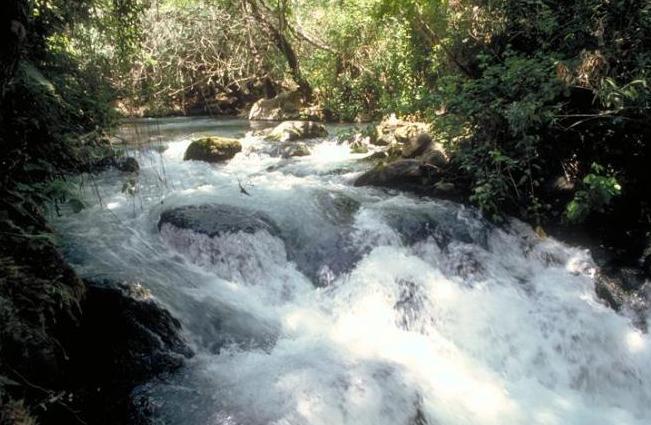
Banias River
Banias, as well as being a place of great natural beauty, is the site of ancient Caesarea Philippi, where Yeshua demanded to know of His disciples who people were saying He was. The story has added poignancy because of the location: Caesarea Philippi was the local centre of the Cult of Pan (hence Panias/Banias) and, as being close to the source of the Jordan, had the river gushing out of a cave that led people to declare it was the river Styx, the gateway to the underworld.
Mark Chapter 8
27 And Yeshua went on with his disciples, to the villages of Caesarea Philippi; and on the way he asked his disciples, “Who do men say that I am?” 28 And they told him, “John the Baptist; and others say, Elijah; and others one of the prophets.” 29 And he asked them, “But who do you say that I am?” Peter answered him, “You are the Christ.” 30 And he charged them to tell no one about him.
.JPG)
Akko (Acre)
The waves from the Mediterranean Sea crash against the walls of Acre’s old city, washing the steep, thick sandstone walls that have survived the centuries. The walls, fortresses and strongholds of the city bear the marks of many nations that left impressive buildings behind them, beautifying Acre to this day. Thanks to these buildings, UNESCO declared Acre a World Heritage Site in 2001.
A visit to Acre is part of the Israeli experience. The city is a meeting place for East and West, new and old, beauty and ruins, all adding to its uniqueness. The variety of tourism sites makes Acre a bustling city full of cultural events, and there is another interesting adventure or attraction around every corner.
Acre was one of this region’s important cities in ancient times. Various cultures made their home here, the Crusaders captured it and the Ottomans lived here for many centuries. Even Napoleon Bonaparte tried to lay his hands on Acre and conquer it, but after two months of siege and failed attempts to storm the city’s walls, he retreated in humiliation.
The fascinating history that has passed through the streets of Acre, the legacy left behind by its conquerors, the buildings that adorn the city and the places of worship built there are just part of the experience this city offers. Among the high-walled alleys and underground passages there is a huge mosque and a Christian monastery, an inn and Turkish baths, halls built by the Knights Templar, with an extraordinary Templar tunnel and fascinating archeological findings. These are joined by intriguing museums and many churches, a row of hotels near the inviting beaches, a marina, restaurants and a picaresque fishing port.
Every year Acre hosts colorful festivals that attract thousands of visitors and tourists from around the world. Between the ancient alleyways a lively open market hums with activity, especially on weekends. The market is also the home of one of Israel’s most famous hummus restaurants, where one sometimes has to wait in line for a table for two. Nearby, in the fishing port, there are excellent fish restaurants that serve the best of the previous night’s catches. Not far away from the city is a beautifully manicured Bahai Garden, build by members of the Bahai religion in Israel. It is a real pleasure to wander the garden’s paths and enjoy the meticulously designed flower beds.
Acre is interesting and charming, good for a glimpse of the past, a festival or just a romantic evening stroll along the city walls over the sea.
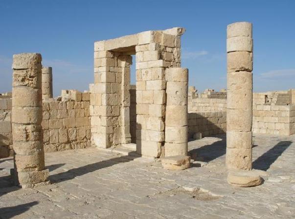
Avdat
As you stand among the ruins of the Negev Highland city of Avdat, the echoes of the bells tinkling on the bridles of the camels that passed this way in their caravans of hundreds, bringing the riches of the East – frankincense and myrrh – to market via the Mediterranean. Avdat was founded by Nabatean traders, the masters of those caravans as a way station on this Incense Route. Long before, the Israelites had wandered near here through the Wilderness of Zin.
At the visitor center a short film will introduce you to the mysteries of this site. Then you’ll visit a luxurious ancient bathhouse with a dressing room, two steam rooms, a furnace and a 210-foot-deep well. At the top of the city, you’ll discover a third-century guard tower with a Greek inscription, and a Nabatean shrine to their god Oboda (after whom Avdat was named). This temple eventually became a church, whose pillars frame a magnificent Negev desertscape.
Considering the surrounding desert, you’ll be amazed to find a wine-press here, revealing agricultural skills that tamed their harsh surroundings by harvesting every precious drop of water into a complex system of channels and cisterns. From the top of the hill, you can see the Ben Ari Farm research station, where today’s Negev farmers have studied ways to emulate these ancient achievements.
Avdat’s homes once covered not only the visitor path you now walk, but the entire slope below, now part of the 518-acre Avdat National Park. Once you’ve experienced Avdat, you’ll know why its ancient cultural, social and economic impact on the region has placed it

Beit She'an
A tour of Beit She’an is like a walk through time. Among the residential buildings, modern public buildings, and modern shopping centers are ancient buildings that were once public institutions, archaeological sites and impressive ruins. Beit She’an is one of the most ancient cities in the country. It is a historical gem that unfolds the fascinating story of a rich period full of changes, climaxing in the National Park of Beit She’an to the north of the city.
Tel (the Hebrew name for abandoned ruins that often appear as hillocks in the countryside) Beit She’an was first settled way back in the Chalcolithic Period (some 5,000 to 6,000 years ago). The city has had many conquerors, among them the Egyptians some 3,500 years ago. A few hundred years later, the Philistines conquered it (it was they who fastened Saul’s body to the wall of Beit She’an after the famous battle on Mount Gilbo’a: 1 Samuel 31 .8 – 11). Beit She’an became part of the kingdoms of David and Solomon, and was eventually destroyed in a fire, apparently at the hands of the King of Assyria (in 732 BCE).
Beit She’an was rebuilt as a Hellenistic city about 2,300 years ago, and was renamed Scythopolis (“City of the Scyths”). In the succeeding Roman period, it spread south, reaching the peak of its greatness in the fifth century, when it had 30,000 – 40,000 inhabitants. The remains of this magnificent city can be clearly seen at the city’s main site – the National Park of Beit She’an, which is one of the country’s most beautiful and impressive national parks. In the northern part is Tel Beit She’an – the location of ancient Beit She’an. South and east of it are the ruins of Roman-Byzantine Scythopolis, which tell of its richness and greatness.
The city extended over an area of some 370 acres, and you can still see the remains of the wall that surrounded it. In addition, several impressive buildings have been uncovered in the national park, including a theatre (still used for events and shows), a public bath-house (the largest found to date in Israel), two magnificent colonnaded streets, a Roman temple, a decorative fountain building (nymphaeum), a large basilica marking the center of the city, and of course the reconstructed mosaic on which you can see Tyche, the Roman Goddess of Good Fortune, holding the Horn of Plenty.
The city remained at its peak for several more years, following which it declined. After the Arab conquest, it sank to the status of a small town. Upon the establishment of the State of Israel, it was resettled and new immigrants came to live here. Today, the city numbers some 18,000 inhabitants.
As mentioned, there are more ruins within the precincts of the new city of Beit She’an, including a Roman amphitheatre (hippodrome), an affluent person’s residence from the Byzantine period, and the remains of a bridge from the Roman period on Nakhal Kharod, which flows at the outskirts of the city. In another part of the city are ruins from later periods, including the remains of a Crusader fortress, a mosque from the Mamluk period, a Turkish government house, and several basalt stone houses from the time Beit She’an was under Arabic rule.
The area surrounding the city is profuse with springs and, consequently, there are abundant nature sites and places to tour. The new youth hostel, one of the most impressive in the country, is worth a visit.
Birket Ram
This tranquil, mysterious pool located on the outskirts of the Druze town of Mas’adeh, has given rise to many stories over the centuries. Its slopes now beautifully cultivated by Druze farmers, it is aptly named Birket Ram – the “high pool” – due to its location in the northern Golan Heights, surrounded by mountains over 3,000 feet above sea level. Its origins are a puzzle, but most geologists believe it is the collapsed crater of a volcano.
A legend about the pool beautifully weaves together geography and human nature: A small hill near Birket Ram is known as Jebel el-Sheikha (“the hill of the sheikh’s wife”), while to the north rises majestic Mount Hermon, nearly 7,000 feet high and known as Jebel el-Sheikh (“the hill of the sheikh”). After many years together, the legend says, the sheikh stopped loving his wife, and Birket Ram is her eye, filled with tears.
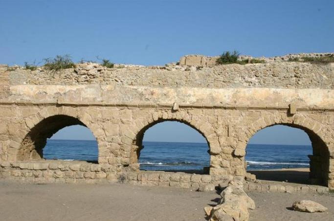
Caesarea
Caesarea is a city of the past and the future, the new opposite the ancient. While new Caesarea is graced with magnificent modern homes, ancient Caesarea offers tourists the ruins of unique, impressive buildings. While golfers enjoy lush fairways, horse races are reenacted in the huge hippodrome in the national park. While modern Caesarea’s neighborhoods are quiet and serene in the glory of contemporary architecture, ancient Caesarea is bustling with tourists who come to see the wonders of the past that were built by one of the greatest builders of the ancient world - King Herod.
Caesarea’s antiquities park is one of Israel’s most impressive parks, housing unique buildings from various periods, bearing silent witness to the upheavals that have visited Caesarea over the past 2,300 years. Standing side by side over an area of 500 dunams (125 acres), there are architectural remains from the Hellenistic period (the 3rd century BCE) to the Crusader period (the 12th century), when Caesarea was a port city and spent many years as Israel’s capital. Caesarea was given to King Herod as a present by Augustus Caesar and is named after him. Herod built a massive port there alongside entertainment facilities, bathhouses and temples. In the Byzantine period, Caesarea was an important Christian center. The early fathers of Christianity (Origen and Eusebius) lived there and according to Christian tradition it was here that the first idol worshiper was converted - the Roman centurion Cornelius. In the Crusader period the city was fortified with walls and gates, which were eventually destroyed by the Mamluk Conquest in the 13th century.
A tour of the national park is like walking through a story, and wandering between the ancient buildings one can both sense how people lived here thousands of years ago and enjoy modern, contemporary experiences, such as the enthralling musical performances held in the beautiful Roman Theater. One can walk along the city walls and around the towers, wander through the ruins of the castle and the various temples, watch the horse races in the hippodrome, visit the ancient port and the tiny artists’ square and view the interactive 3-dimensional computer simulations of the city’s past. The port hosts cultural festivals year round and offers a wide range of activities: historic riddles, jeep tours, target practice with a variety of weapons, paintball, Tai Chi on the beach, toga workshops and treasure hunts. Caesarea’s beach offers the beauty of nature and diving enthusiast can explore the underwater ruins in the archeological park beside the port.
Alongside all the ruins are modern cafes, quaint restaurants, romantic corners and a sandy beach, and not far away is the ancient aqueduct that brought water to the ancient city of Caesarea, 9 kilometers away. Next to the national park is the rural town of Caesarea, which took its name from the ancient city. The town is full of activities, including golf courses, a pampering spa, fancy hotels, the Ralli Art Museum and a historic site that houses the remains of a magnificent palace with a mosaic floor of amazing birds and a rare and unique table top inlaid with glass and gold.
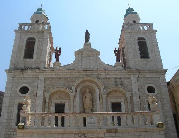
Cana: Wedding Church and Church of Nathanael
The Arab village of Kafr Cana in the Lower Galilee is identified in Christian tradition as Cana of the Galilee. Here, according to tradition, Yeshua performed the miracle of the wine, when he went to a wedding of a poor couple and turned water into wine. In the 17th century Kafr Cana was officially recognized by the Vatican, and the pope officially confirmed that Kafr Cana is indeed Cana of the Galilee. Following this recognition the village was added to the list of Christian holy places. Some researchers identify Kafr Cana with the Kana mentioned in the ancient Egyptian Amarna letters (from about 4,000 years ago).
One way or the other, in the Roman-Byzantine period (1,000-2,000 years ago), there was a large Jewish community here, but apparently by the Mameluke period (about 800 years ago) most of the residents of Kafr Cana were Christian, although there was still a Jewish community here, too. Today most of the residents of Kafr Cana are Muslim.
In the center of the village are a few remains of ancient buildings and burial caves. The villagers have built new houses to the southeast and northeast of the ancient village. The most important site in the village is the Catholic church, built in 1879, on the traditional site of the miracle of the wine. Beside this church is the Greek Orthodox church of St. George, built in 1886, which house two stone jars that Greek Orthodox followers believe are the jars in which Yeshua performed the miracle of the wine.
There is also a church named after St. Bartholomew, built, according to tradition, on the site of the home of Nathaniel of Cana (St. Bartholomew), one of Yeshua’ disciples.
Some 200,000 tourists visit Kafr Cana annually. Inspired by the miracle of the wine, a tradition has developed of holding weddings here, as well as renewing wedding vows to strengthen a marriage, and visitors customarily buy wine here. The street of the churches, in the center of the village, has been renovated and a promenade has been built, connecting the religious centers. Small plazas have been built along the promenade, with rest spots, and the facades and courtyards of the buildings have been attractively refinished. Infrastructure has been laid alongside the promenade for commercial and hotel facilities, so that visitors will be able to combine the comforts of modern tourism with their religious experience.

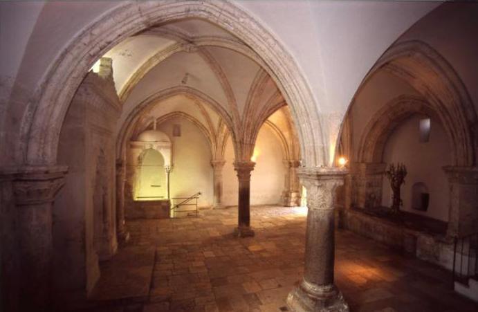
Coenaculum - LastSupper
The Room of the Last Supper
The Coenaculum is the traditional place for the "upper room" where the Last Supper was held. The crusaders, being literalists, made sure their chapel was on the second-storey of the building and "David's tomb" was subsequently installed below. It is also associated with the room belonging to John Mark's mother in which the disciples were baptised in the Holy Spirit, but this is difficult to verify.
In 1335, 80 years after the collapse of the crusader kingdom, the Franciscans who had remained at their posts as Custodians of the Holy Land bought the sight from the Caliphate. They were involved in an argument with the Jews over David's tomb in the 15th century, only solved by the Muslims taking charge and turning all of it into a mosque in 1551. Today Christians and Jews still share the building
Luke Chapter 22
7 Then came the day of Unleavened Bread, on which the passover lamb had to be sacrificed. 8 So Yeshua sent Peter and John, saying, “Go and prepare the passover for us, that we may eat it.” 9 They said to him, “Where will you have us prepare it?” 10 He said to them, “Behold, when you have entered the city, a man carrying a jar of water will meet you; follow him into the house which he enters, 11 and tell the householder, ‘The Teacher says to you, Where is the guest room, where I am to eat the passover with my disciples?’ 12 And he will show you a large upper room furnished; there make ready.” 13 And they went, and found it as he had told them; and they prepared the passover.
14 And when the hour came, he sat at table, and the apostles with him. 15 And he said to them, “I have earnestly desired to eat this passover with you before I suffer; 16 for I tell you I shall not eat it until it is fulfilled in the kingdom of Yahweh.” 17 And he took a cup, and when he had given thanks he said, “Take this, and divide it among yourselves; 18 for I tell you that from now on I shall not drink of the fruit of the vine until the kingdom of Yahweh comes.” 19 And he took bread, and when he had given thanks he broke it and gave it to them, saying, “This is my body which is given for you. Do this in remembrance of me.” 20 And likewise the cup after supper, saying, “This cup which is poured out for you is the new covenant in my blood. 21 But behold the hand of him who betrays me is with me on the table. 22 For the Son of man goes as it has been determined; but woe to that man by whom he is betrayed!” 23 And they began to question one another, which of them it was that would do this.
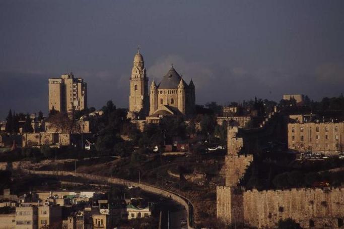
Church of the Dormition
This marvelous church is a landmark of the city, and is the site where the Virgin Mary is said to have died, or fell into 'eternal sleep'. Its Latin name is "Dormition Sanctae Mariae" (Sleep of St. Mary). The current church and Monastery, owned by the German Benedictine Order, was consecrated in 1906. It was noticeably damaged during the battles for the city in 1948 and 1967. In the crypt of the church lies a recumbent statue of the Virgin in death, and the rotunda above is noticeable for its glorious mosaic zodiac, a most unusual addition to a Christian church.
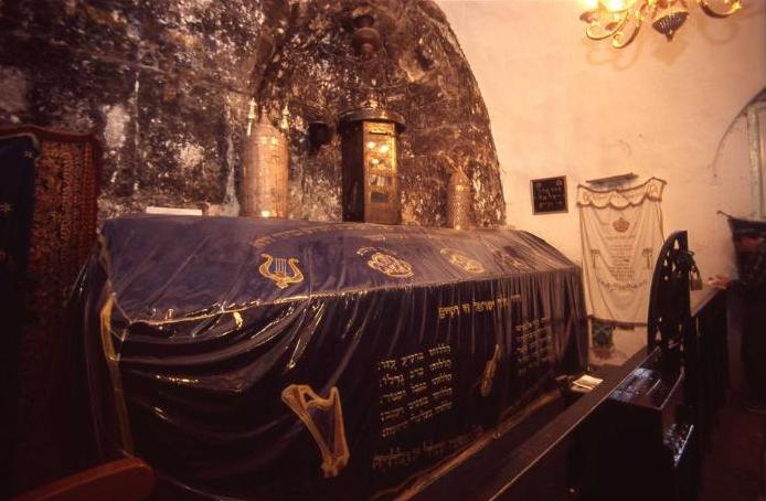
King David's Tomb
The thousand-year-old building that houses the Tomb of King David on Mount Zion in Jerusalem is almost always thronging; some have come to pray and pay homage to Israel’s famous king and ancestor of the Messiah, while others pour over sacred texts all day long in the anteroom next to the tomb.
Jews have streamed here for centuries to recite the Psalms written by David, whose life teaches many lessons about human nature.
The tomb is covered with a velvet cloth embroidered with the words David Melech Israel Hai Vekayam, the first song many Jewish children learn, which evokes the sense that David’s spirit is still with us.
Prayers at King David’s tomb also turn to Jerusalem, which David made the united capital of the tribes of Israel. The anniversary of David’s death coincides with the eve of Shavuot, when it is customary to pray and study all night at the tomb.
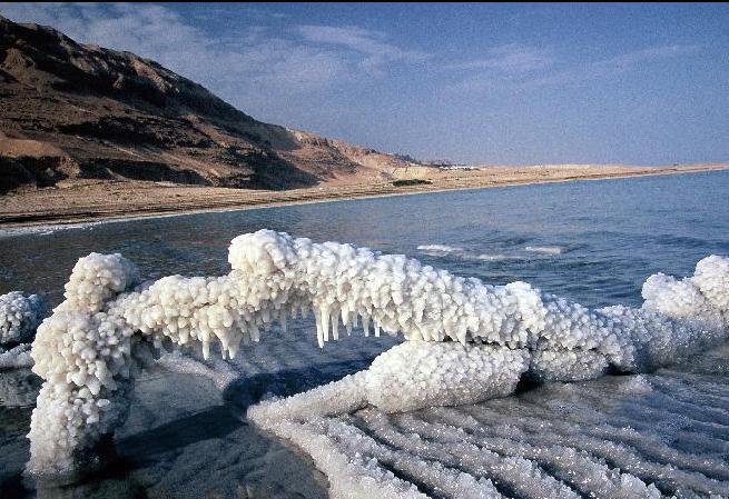
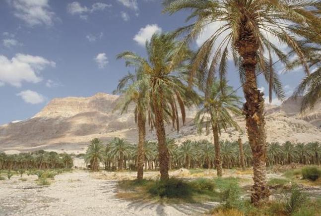
Dead Sea
How far does one have to descend to reach the Dead Sea? About 400 meters below sea level. How deep is this salty lake? Almost the same (in the northern section). Fascinating? Absolutely! Every detail about the Dead Sea is fascinating.
Here are a few more: The Dead Sea is the lowest point on earth in any land mass (417 meters below sea level, to be exact). The quantity of water that evaporates from it is greater than that which flows into it, such that this body of water has the highest concentration of salt in the world (340 grams per liter of water).
It is called the Dead Sea because its salinity prevents the existence of any life forms in the lake. That same salt, on the other hand, provides tremendous relief to the many ailing visitors who come here on a regular basis to benefit from its healing properties. All these and more make the Dead Sea so fascinating, so different and so interesting.
The Dead Sea can also be called “the lowest health spa in the world.” Sea salts are produced from the southern section for industry, and in the northern section promote tourism and good health. The composition of the salts and minerals in the water are what make it so unique and beneficial for the body.
The sea bed also has deposits of black mud that is easy to spread on the body and provides the skin with nourishing minerals. As if that were not enough, the bromide in the air is also beneficial to the body’s systems, thus making the Dead Sea a provider for good health and healing for vacationers from all over the world.
It is a truly priceless national treasure. The western shore (inside Israel’s borders) is dotted with organized beaches and bathing areas that provide convenient access to the water. Beside two of the therapeutic beaches (Neve Zohar and Ein Bokek) large tourism centers have been established, providing the most pampering tourism services.
You will find dozens of hotels, hostels and guest houses, restaurants and shopping centers, as well as surprising tourism enterprises that offer a wide range of challenging activities (jeep and bicycle tours, camel tours and Bedouin hospitality, rappelling and more), alongside art and cultural activities (galleries and artists’ studios), and of course the unique agriculture, adapted to the local climate.
The Dead Sea is on the edge of the Judean Desert, a hot, barren region at the foot of Ha-He’etekim cliff, which has also become an important center of desert tourism. The coastline is dotted many springs, surrounded by wild plant life. The special combination that has formed in this place, between desert landscapes and oases with plentiful water, plants and animals, attracts both the eye and the heart and draws many tourists to sites such as Mt. Sdom, Nakhal Darga, the Ein Gedi nature reserve and the Einot Tsukim (Ein Fashkha) reserve.
Alongside these breathtaking natural sites there are also some purely historic sites of considerable importance in Israel’s past, which preserve the ancient charm of this area. Among the most prominent sites are the Massada (Metsada) fortress, ancient Ein Gedi and the Kumran cave site where ancient scrolls were found, including the Dead Sea scrolls, which offer some insights into early Christianity and the Essenes sect that lived at the site and is considered the beginning of Christian monasticism.
The northwestern region of the Dead Sea is also a pilgrimage site for Christians who have visited here over the centuries especially during the Easter season. From here they go to the Jordan (the traditional site of Yeshua’ baptism), and many still follow this tradition in our times. A tour of the Dead Sea region would not be complete without a visit to the amazing monasteries built on the cliff walls. In the fourth century ascetism became popular among Christians, who wanted to live their lives as Yeshua had. Many believers wanted to devote themselves to Yahweh and the Judean Desert became a ideal destination for monks, who built phenomenal monasteries, some of them carved into the stone faces of the desert cliffs. Among these monasteries are St. George, Quruntul, Khozeba and Mar Saba. Some of the monasteries are still operating and even welcome visitors, who can gain their own impressions of the intensity of the desert and its wild beauty.
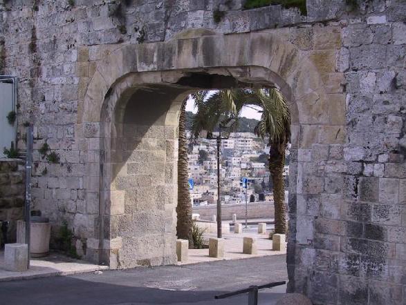
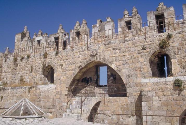
The Gates of Jerusalem
Jerusalem’s Old City walls, built in the early 16th century by the Turkish Sultan Suleiman the Magnificent, have eight gates. All but one (the Gate of Mercy) still serve Jerusalemites and visitors streaming to its markets, and sacred and historic sites.
Below is a thumbnail description of the gates, counter-clockwise from south to west:
The Zion Gate: Bearing Jerusalem’s earliest biblical name in Hebrew and English, this gate’s Arabic name is the Gate of the Prophet David, as the Tomb of King David, on adjacent Mount Zion, is only a few steps away. Zion Gate leads directly to the Armenian and Jewish quarters.
The Dung Gate: This gate’s unusual name derives from the refuse dumped here in antiquity, where the prevailing winds would carry odors away. Nehemiah 2:13 mentions a Dung Gate that was probably near this one. This gate leads directly to the Western Wall and the Southern Wall Archaeological Park.
Gate of Mercy: This gate, in the eastern Temple-Mount wall, may be the best-known of them all. Also called the Golden Gate or the Eastern Gate, it has been blocked for centuries, and is said to be awaiting a miraculous opening when the Messiah comes and the dead are resurrected.
Lion’s Gate: This portal is named after a pair of ferocious-looking animal carvings that flank it. They are actually tigers, the heraldic symbol of the 13th-century Sultan Beybars. It is also called St. Stephen’s Gate, after the first Christian martyr, who tradition says was stoned nearby. Lion’s Gate, which leads to the Pools of Bethesda, the Via Dolorosa, and the markets, became famous during the Six Day War.
Herod’s Gate: Despite its name, the notorious Judean king had nothing to do with this gate. In Arabic and Hebrew this north-facing gate, which leads to the Old City markets, is called the Flowers Gate. Some say the name derives from a rosette carved over it. However, in Arabic a similar word means “awakened,” and may refer to a nearby cemetery and the hope of resurrection.
Damascus Gate: This most imposing of Jerusalem’s gateways also faces north and is named for the grand city from which Jerusalem’s rulers once came. It is always a busy thoroughfare, thanks to the bustling markets within. Below the 16th-century gate, archaeologists have uncovered part of the entryway built by Emperor Hadrian in the second century CE.
The New Gate: This is the only Old City entryway not part of the original design of the 16th-century walls. It was breached in the waning days of the Ottoman Empire to allow Christian pilgrims quicker access to their holy places within the ramparts.
The Jaffa Gate: This was the destination of Jewish and Christian pilgrims disembarking at the Jaffa port, hence its name. It led (and still leads) directly to the Jewish and Christian quarters, as well as to the most popular parts of the market, and to the Tower of David Museum, once Jerusalem’s citadel and now a showcase of its history.
Dominus Flevit
This beautiful teardrop chapel - which name means "the Lord Wept" - was only built in 1955 over the site of a Byzantine construction. It commemorates the occasion of Yeshua looking at the city of Jerusalem and, when realising that it was going to destroy itself by violence, weeping bitterly.
In the grounds are the remains of a Byzantine church, as well as part of the first century necropolis that surrounded the city. Extraordinary view.
Luke Chapter 19
41 And when he drew near and saw the city he wept over it, 42 saying, “Would that even today you knew the things that make for peace! But now they are hid from your eyes. 43 For the days shall come upon you, when your enemies will cast up a bank about you and surround you, and hem you in on every side, 44 and dash you to the ground, you and your children within you, and they will not leave one stone upon another in you; because you did not know the time of your visitation.”
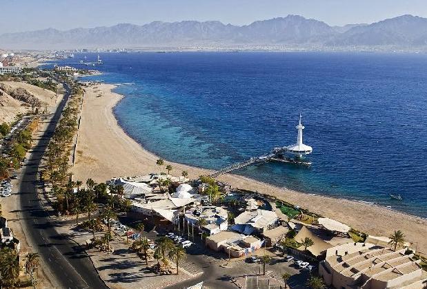
Eilat
Over the years, the city of Eilat has become the ultimate resort city with hotels and beaches packed with thousands of Israeli vacationers and tourists from around the world, who come to relax in the country’s southernmost spot.
In the winter it mainly attracts tourists from Europe who prefer vacations in a warmer and more pleasant climate while Israelis flock to the city in the summer. The secret of this little city’s charm is its special location in the northern end of the Bay of Eilat. The combination of a hot climate, a tropical sea and a breathtaking background of wild, bare granite mountains has turned it into a tourist gem all the year round.
Eilat’s location made it strategically significant during the many historical periods in which it served as a port – starting in the days of King Solomon (who built a large fleet of ships which he sent to Ophir), through the Nabataeans, the Romans, the Arabs, and the Crusaders, all of whom ruled the Land of Israel.
The modern city of Eilat was established in 1950. In the early 1950s, a quay was built in the new city, and subsequently a port which became the basis for the new city’s economy. Towards the end of the 1960s, the tourism industry started developing in the city, and today Eilat is a paradise for tourists, travelers and vacationers.
The bay is one of the major attractions, thanks to the beautiful beaches, the developed water sports and some of the best diving spots in the world. In the south of the city is the Coral Reserve, with splendid tropical fish among the reefs. Within the precincts of the reserve is the Underwater Observatory, with a marine museum that displays collections of fascinating sea animals. Not far from the observatory is the Dolphin Reef with its resident school of dolphins.
The city’s many and varied restaurants suit all tastes, and there are also clubs, colorful shops and a promenade along the northern shoreline which holds vibrant bazaars during the summer. There are additional attractions for youngsters and families, such as an amusement park, a new “Kings City” (a high-tech theme park for all the family based on the Bible and Bible stories). Eilat also has an IMAX movie theatre offering a 3-D experience, and many more leisure time activities.
The Arava region north of the city and the Eilat Mountains is an arid desert. But in between the exposed mountains there are many nature and beauty spots as well as archaeological and historical sites, which make Eilat a good starting point for special trips in the area, such as camel treks, jeep tours and more.
A prosperous Jewish settlement at Ein Gedi was destroyed at the time of the rebellion against the Romans. The main finding at the Ein Gedi Antiquities National Park is the ruins of a synagogue from the Byzantine period. Next to it are remains of a settlement, including a pool, part of a street, and several houses.
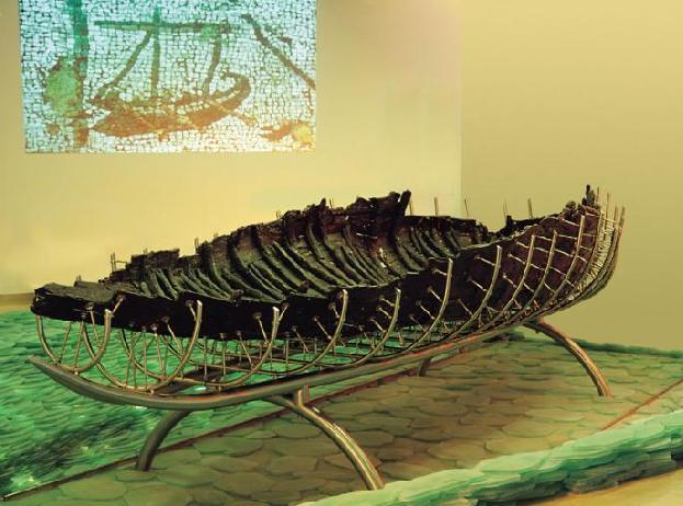
Galilee Boat
For Christians, the Galilee Boat is one of the most precious and meaningful archaeological treasures in the world.
On a drought-dried shore of the Sea of Galilee in January 1986, two brothers who were fishermen from Ginosar—called Gennesaret in Yeshua’ day (Matt. 14:34, Mark 6:53)—spied a mysterious object poking up out of the mud. Twelve days later, an ancient vessel saw the light of day for the first time since it sank nearly 2,000 years ago.
Scholars say it was a combined ferry and fishing boat, and might have even served in a sea battle against the Romans, but for more than a million Christians who have seen it over the years, and for those looking forward to doing so, it will always be “the Yeshua boat.” While no one knows exactly who rode in the boat or what its purpose was, it serves as a powerful visual reminder of the Gospel stories of Yeshua and his disciples, many of whom were fishermen themselves.
After complex restoration, the Galilee Boat now sits above a calm blue-green sea at the Yigal Allon Center at Kibbutz Ginosar. At this superb indoor display, visitors learn that this mainly oak-and-cedar craft was patched repeatedly and lovingly with 12 different kinds of wood, and that these very trees still grow along the walk to the museum.
Sculptor and kibbutz gardener Yuvi Lufan, who along with his brother Moshe discovered the boat, is now part of the living history of the Galilee Boat. “Our parents taught us to love the Sea of Galilee,” Lufan says, “and I always knew it would give us a gift. And it did—a legacy that brought something special to the whole world.”

Haifa
Israel’s third largest city and one of its prettiest, Haifa has a lot to offer visitors. It has the country’s largest port, a particularly active beach and is the home of the World Center of the Bahai Faith. Surrounded by abundant nature sites, the city contains an interesting mix of modern neighborhoods and older districts; churches and mosques; mountain and sea.
Haifa is a multi-faceted city with several unique characteristics making it an attractive place to visit. Its proximity to the sea and its active port contribute to its prominence. The bustling port area draws merchants, shoppers and tourists. The beautiful beaches are popular for sports and recreation, and are filled with people during summer weekends. In addition, because of their excellent surfing conditions, the beaches serve many of Israel’s top sailing enthusiasts and host sailing competitions and other sporting events.
With residents from the three largest religions as well as from various minority faiths, Haifa is also a symbol of outstanding co-existence and tolerance. Nine percent of the population consists of Arabs (Moslems and Christians) who reside mostly in three neighborhoods: Khalisa, Abas and the famous Wadi Nisnas whose charming alleyways have turned it into a tourist spot. The annual Holiday of Holidays marking the city’s special lifestyle is held there.
The Christian presence in Haifa, with its many churches, also contributes to the city’s image. A Maronite church is located next to Kikar Paris (Paris Square); adjacent to that is the Carmelite church dedicated to the Prophet Elijah; and not far from there is Saint Mary’s Greek Orthodox Parish Church. The Sacre Coeur Catholic School on Allenby Street has a well-tended garden and building, in front of which are impressive statues of Saint Mary. Atop the Carmel, holy to Christians, is the Stella Maris Carmelite Monastery. In the monastery’s Baroque-style church is a cave considered by Christian tradition to be the grave of the Prophet Elijah, and in the monastery is a small museum dedicated to his life. On site is also a hostel which serves the many pilgrims who visit the city.
This does not complete the city’s religious mosaic. Israel’s only Ahmadi Muslim community is based in Haifa’s Kababir neighborhood. The Ahmadiyya is an Indian sect of Islam, founded in the late nineteenth century, which promotes peace among nations and opposes religious coercion. Their large mosque houses a prayer hall and a first-floor exhibit of their history and significant contributions.
Haifa’s reputation for tolerance extends to the Bahai Faith whose World Center is located in the city. The Bahais originated in the Bab sect which separated from Iran’s Shi’ite Islam in 1844. The Bahai World Center, an expansive and well-designed complex on the slope of the Carmel, is famous for its magnificent gardens. It includes the exquisitely landscaped “Hanging Gardens” which run about a kilometer along the Louis Promenade until Ha-Gefen Street. At the center is the impressive, gold-domed Shrine of the Bab, the burial place of the Bab, the founder of the faith. One can enjoy some enchanting spots while strolling through the beautiful gardens by day, but with the special lighting, an evening visit provides equal pleasure and a peaceful, romantic atmosphere.
At the foot of the Bahai Gardens lies the picturesque German Colony, founded in the nineteenth century by German Templars who came to establish a Christian community in the Holy Land. The pretty stone houses lend charm and romance to the neighborhood and reflect its special qualities. Some of the houses have been preserved, and some still have the names of the original residents etched onto them. The German Colony attracts many visitors, and it is worth wandering through it to enjoy its beauty and get a sense of its colorful past.
Those interested in experiencing the city by foot will enjoy one of the “Step Tours”, four marked walking routes which begin on Yefe Nof (Panorama) Street and proceed down to the beach area.
Other options are nature routes which descend the mountain along one of the rivers – Ezov, Akhuza, Lotem and Si’akh. From the coast, one can go up the mountain via the cable car or the Carmelit, Israel’s only subway (underground) which ends at the Carmel district. Here, one should visit Gan ha’Em (“Mother’s Park”) and walk along the Louis Promenade with its spectacular view of the city which hugs the sea.
Haifa also boasts many institutions devoted to culture, art and science which offer an array of festivals and activities. Several types of museums are located in Haifa, including: the Dagon Grain Silo; the National Maritime Museum; the National Museum of Science and Technology; the Haifa Museum of Art; the Clandestine Immigration and Naval Museum; the Railway Museum; the Tikotin Museum of Japanese Art; the Reuben and Edith Hecht Museum; and the Israel Oil Industry Museum.
The annual Haifa Film Festival features high quality local and international films, drawing those in the profession (directors, screenwriters, actors, etc.) as well as thousands of visitors who fill the streets and the auditoriums.
Haifa is also home to the Technion, Israel’s first institution of higher education, and to the University of Haifa, attended by students from Israel and overseas. The university is situated near the Carmel Nature Reserve, known for its year-round views of greenery and its intoxicating beauty. The Khai-Bar Wildlife Preserve was established within the Carmel Nature Reserve to reintroduce nearly extinct animals to nature.
Throughout the Carmel are hundreds of hiking, automobile and bicycle paths, and amazing charming spots waiting to be discovered.

Hamat Tiberias National Park is located on the ancient site of Hamat Tiberias (Tverya), a site first built during the Hellenistic age and then developed as a bath complex during the Turkish period. The museum exhibits the history of the baths, which are based on the 17 hot springs that feed the nearby modern Hamei Tiberias. The ruins of pre-Hellenistic Tverya were discovered nearby

Jezreel Valley
The Bible, geography and ancient and modern history in the Jezreel Valley are perhaps more closely entwined and visible than anywhere else in the country.
The central Jezreel Valley, roughly 380 square kilometers in size, is bounded on the north by the Nazareth mountains and Mount Tabor, on the east and south by Mount Gilboa and the mountains of Samaria respectively, and on the west by Mount Carmel – all of which are Scriptural stars.
The passes through these mountains have been significant in world history for thousands of years, emphasizing Israel’s role as a bridge linking Africa, Asia and Europe. Ancient caravans bearing merchandise and the innovations of far-off cultures, and the armies of antiquity passed this way, as attested by the famed ruins of some 25 cities at Tel Megiddo, Tel Jezreel and other antiquities sites.
Jezreel means “God will sow” – a hint at its fertility, although by modern times neglect had turned most of it into swamps. But beginning in 1911, pioneers drained the swamps, making the valley bloom again.
Today it is Israel’s breadbasket, sprouting wheat, cotton, sunflowers and even fish ponds. Among its many attractions are historical and biblical treasures such as Tel Megiddo (Armageddon) national park, the mosaics at Beit Alfa and Tzippori national parks, the cultural mosaic represented by the Circassian village and museum in Kafr Kama and the pioneering and historical museums at Kfar Tabor and Kibbutz Ein Dor, family fun and hands-on learning at places like the silk and honey farm at Moshav Shadmot Dvora, countryside cuisine at the region’s many fine restaurants, hiking portions of the Israel Trail and the Bible Trail on Mount Gilboa, a wide selection of bed-and-breakfast accommodations run by rural families, as well as the numerous religious and heritage sites in Nazareth, and more, all make the Jezreel one of Israel’s most inviting visitor destinations.
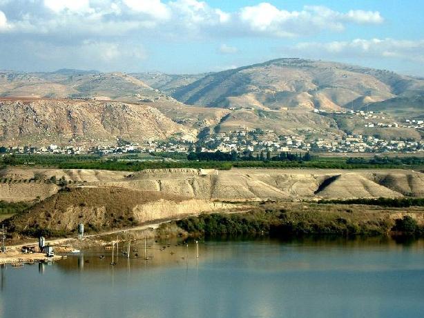
The Jordan Valley
The Jordan Valley, extending from the outlet of the Jordan River at the Sea of Galilee to its inlet into the Dead Sea, a little over 100 kilometers to the south as the crow flies, reveals the variety of landscapes and sites for which Israel is famous, highlighted here from north to south. The Jordan emerges from an area of stately date groves near the first kibbutz, Degania, flows past the Pilgrim’s Baptismal Site and becomes the peaceful border between Israel and the Hashemite Kingdom of Jordan. In fact, you can cross into Jordan at the Sheikh Hussein Bridge, just opposite the city of Beit Shean.
But even before you get to Beit Shean, with its fabulous biblical, Roman and Byzantine remains, you can learn about the region’s rich prehistory at the Kibbutz Sha’ar Hagolan Museum, and then drive up to the Crusader fortress of Belvoir to get an overview of the magnificent landscape. At the Kfar Ruppin Birdwatching Center you’ll discover that the Jordan Valley, part of the Syrian-African Rift, is not only a famed ancient highway; it is one of the world’s major bird-migration routes.
From ancient to modern history means just a short drive in this valley: South of Belvoir is Naharayim, where the Yarmuk River flows from the east into the Jordan, the reason the Middle East’s first hydroelectric power plant was founded here in 1932. At nearby Old Gesher, you’ll hear the story of that technical wonder of its day, along with the saga of the area’s historic bridges and of Kibbutz Gesher in 1948. The Jordan River Peace Park is an exciting, future cross-border project of this area. As you continue south, you’ll enjoy the gradually changing landscape, becoming increasingly arid as it eventually dips to around 400 meters below sea level. Thanks to modern irrigation techniques, the region is dotted with orchards, date groves, vineyards, and flower and vegetable greenhouses, and you’ll also see shepherds with their flocks. Further south, you’ll pass the area where the Israelites crossed the Jordan, and you’ll see their first destination, the rich oasis of Jericho, the oldest city in the world. The road detours the city and passes the entrance to another Jordan crossing, the Allenby Bridge. Next, near the T-junction where you’ll decide whether to continue southeast to the Dead Sea or northwest to Jerusalem, a sign directs you to the inviting Greek Orthodox monastery of Dir Hijleh.

Katsrin - Golan Heights
A pleasant north wind greets visitors to Katsrin - the capital of the Golan Heights. Founded in 1977, it has become an urban, commercial and tourism center. Katsrin is built in the heart of the Golan Heights and is a young city known for its landscapes and its quality of life. Its special location affords easy access to many nature reserves, historic and archeological sites, river beds and attractive visitor centers.
The city is named after the ancient town of Katsrin, whose ruins are located in the nearby Katsrin antiquities park. The ancient town was inhabited on and off from the Middle Bronze Age (about 4,000 years ago) and archeological digs found evidence of a Jewish village from the Talmudic period, which existed until the Moslem conquest just over 1,300 years ago. The remains of the ancient village are fascinating with reconstructed homes, complete with their interiors and the farming implements used by the inhabitants. The central site is a magnificent synagogue from the 6th century, evidence of a prosperous community. The park is full of beautiful rest spots, surrounded by fig trees and grape vines, and there is also a museum of modern basalt sculptures.
The Katsrin industrial zone houses a mineral water bottling plant and a large winery, among the most famous in Israel, and both have visitors’ centers that offer a glimpse of the water-bottling and wine-making processes. The Golan Antiquities Museum is located in the commercial center in Katsrin, with exhibits of archeological findings from the region as well as an impressive audiovisual presentation of the heroic defense of the town of Gamla against Roman forces in the 1st century. Also at the center is a doll museum depicting the history of the Jewish people up until the renewal of Jewish settlement of Israel and the Golan Heights in the late 19th century. Between the two museums are stores, pubs and restaurants, a few guest rooms and a field school that offers sleeping accommodations in hostel rooms as well as outdoor camping and guided tours.
The nature and historical sites near Katsrin include Nahal Zavitan, the Meshushim Pool with its unusual hexagonal rocks, Gamla, Nakhal Yehuda and Seleukia Springs.
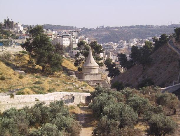
Kidron Valley
The Kidron Valley is one of Jerusalem’s most sacred locales, due to its location between the Temple Mount and the Mount of Olives.
On the Mount of Olives is the world’s oldest Jewish cemetery, where it is believed the resurrection of the dead will begin when the Messiah comes. Legend has it that a miraculous bridge will span the valley at the end of time, over which the righteous will pass on their way to the Temple Mount.
This part of the Kidron is also called the Valley of Jehosafat, where Yahweh will judge the nations of the world (Joel 3:12). Another name for the valley is the Vale of the King; it was once intensely cultivated and the revenues went to the king.
Many olive trees have recently been brought here to restore the ancient landscape. The Kidron also has the earliest tombs in the cemetery: Zechariah’s Tomb, named after a First Temple priest, the Tomb of the Sons of Hezir, a Second Temple-era priestly family, and Absalom’s Tomb.
The conical-roofed Absalom’s Tomb received its name because the Bible says this rebellious son of David built a monument here so he would be remembered. Absalom was eventually killed by his father’s men; Jerusalemites of old would bring their sons to pelt the tomb with stones and recall the fate of rebellious offspring.

Massada
Massada is one of the most exciting and frequently-toured places in Israel, and relates a story of perseverance and power, faith and surrender, ambitions, and a tragic end. Massada is a place where battles were waged with rocks and flaming arrows, as well as battles of the human spirit.
Massada is situated on the top of a mountain with steep sides and a flat top like a parapet overlooking the desert panorama to the west and the Dead Sea to the east. The thrilling story of the site reveals the courage of the defenders of Massada and their battle against the conquering Romans.
The story, related against the background of the ancient panorama, is as thrilling as a Hollywood movie, and is filled with tension, struggle, and love.
The fortress of Massada was built in the year 30 BCE by King Herod, whose architectural feats have left their mark throughout the country. At the beginning of the great revolt against Rome in the year 68 BCE, the site was conquered by a group of Jewish zealots, and Massada became their last stronghold. In the year 72 the Romans besieged Massada and succeeded in reaching the steep fortress after constructing a huge earthen ramp on its western side. In the year 73, the 960 Jewish zealots living at the top of Massada chose to commit suicide rather than to fall into the hands of the Romans alive. Their deeds left behind a saga of courage, heroism, and martyrdom.
The remains of the fortress of Massada are well-preserved and have been reconstructed in an effort to pay homage to the site and its heroic inhabitants.
The most impressive structure on Massada is King Herod's northern palace, built on three rock terraces overlooking the gorge below. Near the palace is a large Roman style bath house with a colorful mosaic floor and walls decorated with murals. Many other buildings at the site - such as the luxurious western palace, the mikveh (Jewish ritual bath), storerooms, watchtowers, and synagogue relate the history of Massada, especially when viewed with artifacts such as storage containers, decorated pottery, scrolls, and coins.
The beautiful embossments and murals that were discovered on the walls of buildings on Massada were restored by Italian experts to preserve them for years to come. This is the largest and most complete Roman siege camp that remains today.
Massada is extremely high, and can be ascended on foot by the winding "snake path" or by a cable car that runs from the tourist center at the feet of Massada to the top.
The tourist center also features a movie about the story of Massada, a model of the site, and an exhibit of the archeological findings.
A visit to Massada is a thrilling and exciting experience. The chilling story and the archeological remains contribute to the special atmosphere of the site, and preserve its magnificent past.
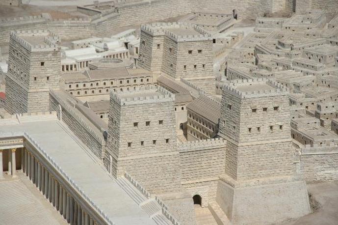
Model of Second Temple Jerusalem
The Model of Second Temple Jerusalem, one of the capital’s best-loved visitor sites, first opened in 1966 on the grounds of a Jerusalem hotel. It was built at the behest of the hotel’s owner, Hans Kroch, in memory of his son Jacob who fell in Israel's War of Independence. But when construction activities around the hotel necessitated the model’s move, the Israel Museum welcomed it, and it was reopened in 2006. The 1:50 model now occupies 21,500 square feet next to the landmark Shrine of the Book, where the Dead Sea Scrolls, the earliest copies of the Hebrew Bible ever found, are displayed. Ancient Jerusalem’s palaces, homes, courtyards, gardens, theater and markets are all there in intricate detail, crowned by the Temple, the spiritual center of the Jewish People and the largest building project in the world of its day.
A short film, screened in the new auditorium of the museum’s Dorot Foundation Information and Study Center, highlights the complexities of life in those days and is a companion piece to the Shrine of the Book and the model. The plot follows two fictional friends: one an acolyte of the sect that lived at Qumran where the Dead Sea Scrolls were discovered, the other a young Jerusalem priest, as each seeks his spiritual path in troubled times.
The model’s new setting allows visitors both to circumnavigate it and to view it from above, getting a glimmer of the grandeur of this city, about which the sages said “ten measures of beauty were given to the world; nine were taken by Jerusalem.”

Monfort
The Monfort site features a crusader fortress that towers above the Kziv riverbed. At its feet is a crusader farmhouse that has survived almost completely intact

Mount Tabor
Mount Tabor was an important tribal border in the Hebrew Bible, the place where Deborah routed the enemy, the site of Yeshua' transfiguration and the Rabbinic "navel of the world". But, even without the history, it is still worth ascending for the marvelous view.
Judges Chapter 4
12 When Sisera was told that Barak the son of Abino-am had gone up to Mount Tabor, 13 Sisera called out all his chariots, nine hundred chariots of iron, and all the men who were with him, from Harosheth-ha-goiim to the river Kishon. 14 And Deborah said to Barak, “Up! For this is the day in which the Lord has given Sisera into your hand. Does not the Lord go out before you?” So Barak went down from Mount Tabor with ten thousand men following him. 15 And the Lord routed Sisera and all his chariots and all his army before Barak at the edge of the sword; and Sisera alighted from his chariot and fled away on foot. 16 And Barak pursued the chariots and the army to Harosheth-ha-goiim, and all the army of Sisera fell by the edge of the sword; not a man was left.
Mark Chapter 9
2 And after six days Yeshua took with him Peter and James and John, and led them up a high mountain apart by themselves; and he was transfigured before them, 3 and his garments became glistening, intensely white, as no fuller on earth could bleach them. 4 And there appeared to them Elijah with Moses; and they were talking to Yeshua. 5 And Peter said to Yeshua, “Master, it is well that we are here; let us make three booths, one for you and one for Moses and one for Elijah.” 6 For he did not know what to say, for they were exceedingly afraid. 7 And a cloud overshadowed them, and a voice came out of the cloud, “This is my beloved Son; listen to him.” 8 And suddenly looking around they no longer saw any one with them but Yeshua only.
Mount of Beatitudes
As the name suggests this is the hill upon which Yeshua was said to have preached the "Sermon on the Mount". The lie of the land next to the church forms a natural amphitheatre sloping down to the lake side, so it is more likely that Yeshua stood at the bottom of the hill, but this does not detract from the beauty of the church on its crest.
Matthew Chapter 5
1 Seeing the crowds, he went up on the mountain, and when he sat down his disciples came to him. 2 And he opened his mouth and taught them, saying: 3 “Blessed are the poor in spirit, for theirs is the kingdom of heaven. 4 “Blessed are those who mourn, for they shall be comforted. 5 “Blessed are the meek, for they shall inherit the earth. 6 “Blessed are those who hunger and thirst for righteousness, for they shall be satisfied. 7 “Blessed are the merciful, for they shall obtain mercy. 8 “Blessed are the pure in heart, for they shall see Yahweh. 9 “Blessed are the peacemakers, for they shall be called sons of Yahweh. 10 “Blessed are those who are persecuted for righteousness’ sake, for theirs is the kingdom of heaven.
11 “Blessed are you when men revile you and persecute you and utter all kinds of evil against you falsely on my account. 12 Rejoice and be glad, for your reward is great in heaven, for so men persecuted the prophets who were before you.
13 “You are the salt of the earth; but if salt has lost its taste, how shall its saltness be restored? It is no longer good for anything except to be thrown out and trodden under foot by men.

Mount Of Olives
Located east of Jerusalem’s Old City and separating it from the Judean Desert, the Mount of Olives is one of the most prominent sites in the Jerusalem vicinity mentioned in the Holy Scriptures. It is first mentioned as King David’s escape route during the rebellion of his son Absalom, then later in the prophets; but it is most often referred to in the New Testament, being the route from Jerusalem to Bethany and a favorite location for Yeshua' teachings to his pupils and where he wept over Jerusalem. Here, the Dominus Flevit Church was built by the Franciscan order in 1954 to designs by A. Barluzzi in the shape of a tear atop remains of a Byzantine church.
At the foot of the mountain, adjacent to the Church of All Nations, stand the Gardens of Gethsemane (Gat Shemanim- oil press in Hebrew), in which one finds the golden turreted Russian Orthodox Church of Maria Magdalene. Besides the compound of churches adjacent to Mount Scopus at its north, which includes the Basilica of the Sacred Heart, the Basilica Eleona and the convent of Pater Noster, it is perhaps best known for the extensive cemetery that faces Jerusalem all along its western slopes.
Believed to be the place from which Yahweh will begin to redeem the dead when the Messiah comes, Jews have always sought to be buried here. The most famous of these graves actually lie at the foot of the mountain, flush against the Old City walls, including the Tomb Of Zechariah, the tombs of the sons of Hezir and Yad Absalom. Further up, among the 150,000 graves in the Jewish cemetery, one may find the final resting places of Jewish philosopher Nahmanides, Hebrew language reviver Eliezer Ben-Yehuda, former Prime Minister Menachem Begin, Chief Rabbis Avraham Isaac Kook and Shlomo Goren and media mogul Robert Maxwell.
Presently, the Jerusalem Municipality in conjunction with the Prime Minister’s Office is embarking upon an ambitious renewal and development project for the entire site. The 100 million shekel project includes the renovation of thousands of graves destroyed during the Jordanian rule over Eastern Jerusalem between 1948 and 1967 and the development and maintenance of roads, fences and a tourist information center. The project is expected to last for five years, due to the religiously sensitive nature of the area, which inhibits the use of heavy machinery.

Mt. Hermon
Mt. Hermon is Israel's highest mountain (2,814 meters) and the country's only skiing site. One can ski, ride a cable car up the mountain, race down in extreme sleds or just play in the snow. In early summer there is an abundance of flowers and birds not visible anywhere else in Israel.
Nain Byzantine
Nain is the site of a Byzantine Church that commemorated Yeshua' first raising of a human from the dead. In the last century, a new Church was built by the Franciscans.
Luke Chapter 7
11 Soon afterward he went to a city called Nain, and his disciples and a great crowd went with him. 12 As he drew near to the gate of the city, behold, a man who had died was being carried out, the only son of his mother, and she was a widow; and a large crowd from the city was with her. 13 And when the Lord saw her, he had compassion on her and said to her, Do not weep.14 And he came and touched the bier, and the bearers stood still. And he said, Young man, I say to you, arise.15 And the dead man sat up, and began to speak. And he gave him to his mother. 16 Fear seized them all; and they glorified Yahweh, saying, A great prophet has arisen among us! and Yahweh has visited his people! 17 And this report concerning

Nazareth
Nazareth, or Natsrat as its name is pronounced in Hebrew, is the cradle of Christianity, the city where, according to tradition, the angel Gabriel told Mary that she would conceive by the power of the Holy Spirit, and the place where Yeshua spent his childhood and youth. Nazareth, in the lower Galilee, is located in the heart of a valley surrounded by mountains that embrace several of the most important Christian sites in the world. This is a city of religion and faith, of spirituality and holiness, but also a city with a rich history, fascinating archeology, modern culture and Middle Eastern charm.
Nazareth, which began as a small Jewish village about 2,000 years ago, became a stronghold of Christianity in the Byzantine period, just a few hundred years later. During that period the name of Nazareth spread far and wide, and the yearnings to see the place where the Virgin Mary and Yeshua Christ had lived turned the city into a popular pilgrimage site. These visits led to the building of the city’s first church - the Church of the Annunciation at the traditional site of Joseph and Mary’s home. Many more churches have been built throughout the city, and were destroyed and rebuilt with the changes in Muslim and Christian rule over the centuries. In the 19th century Nazareth attracted renewed interest and Christians returned to live in this city and rebuilt churches and monasteries. Today Nazareth is the largest Arab city in Israel and has about 30 churches and monasteries, as well as mosques and ancient synagogues.
A tour of Nazareth is like reliving its various periods. Every era left behind it a powerful symbol that became a delightful and popular tourism site in the modern era. Most of the sites are concentrated in the Old City, built in the mid-19th century in a charming Middle Eastern architectural style. A walk through the narrow streets, between the picturesque houses, is an amazing experience and it is worth walking slowly to enjoy their beauty.
There are many ancient churches in the Old City, with the Church of the Annunciation heading the list. The rebuilt church retained parts of the previous churches, from the Crusader and Byzantine periods. The church also houses an impressive collection of paintings.
Right next to this church is the Church of Saint Joseph, built on the ruins of agricultural buildings where, according to tradition, Joseph, Mary’s husband, had his carpentry shop. While the Church of the Annunciation was built on the site of Mary’s home, the Greek Orthodox Church of the Annunciation is built over Mary’s Well, from which Yeshua mother is said to have drank. This is a structure from the Crusader period and has some interesting frescoes. Right next to Mary’s Well is the Greek Orthodox Church of the Annunciation, inside a Crusader hall. According to tradition this is the location of the synagogue in which Yeshua prayed.
Among the many other churches in Nazareth are the Mensa Christi Church, the Maronite Church, St. Gabriel’s Church and the Salesian Church. The Old City also has important buildings from the Ottoman period, including the Saraya, or Government House, built by Daher el Omar, the governor of the Galilee in the 18th century, and the White Mosque, which is used today as a house of prayer and an education and culture center. The White Mosque also houses a museum with exhibits that document Nazareth’s history.
No tour of Nazareth’s Old City would be complete without a visit to the local market, which has become a popular and well-known attraction thanks to the colorful stalls and the variety of merchandise. In the market you can enjoy a visual feast of fashionable fabrics, taste the spices and local foods, and by artwork and souvenirs. All the sounds, sights, smells and flavors promise an authentic Middle Eastern experience.
Nazareth is full of fascinating and lovely corners that will open your heart to their beauty. Another place that is worth visiting during a walking tour is the Nabi Sain ridge promenade to enjoy the marvelous view of the Galilee. You can visit the ancient Turkish bath house discovered during renovations to one of the city’s stores, take a peek at a fancy manor house with a display of the riches and customs of the Ottoman upper class in the 19th century, including some amazing frescoes. Also worth visiting is the Greek Orthodox bishop’s house, where you can walk through a series of underground passages discovered in the courtyard. Another interesting site is the compound built by the Russians as a hostel for pilgrims.
Nazareth, which has welcomed pilgrims for centuries, has Christian hostels and fancy hotels for the comfort of the tourists who throng to this important site, especially around Christmas. Dozens of restaurants serve delicious foods with wonderful aromas foods that attract visitors all year long. Nazareth is glorious during Christmas, when the city is decorated for the holiday and its colors and excitement join the holy atmosphere and the sounds of prayer emanating from the city’s churches.
Old City Walls
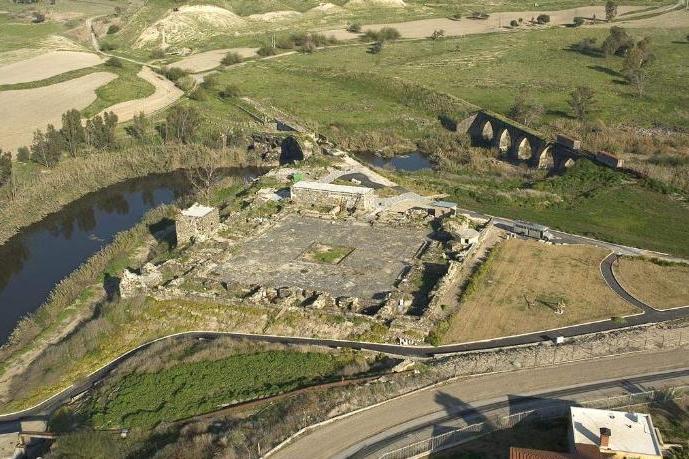
Old Gesher Courtyard
The Old Gesher is located near the Jordan River, and has 2 historic sites that have been damaged in the past and require restoration. One of them is an ancient bridge, whose base was built during the Roman Byzantine era, and built over later, during the Crusader and Mamluks eras (the 12th century A.D.).
The second site is the Mamluks Han (a roadside inn), built during the 14th century on the ancient road that used to cross the Jordan River. The Han controlled an important passage and provided services for the caravans that passed through it. In 1837, the Han was destroyed in an earthquake that struck the region, and over the years it was covered by the marlstone soil.
Following a recent declaration of the American World Monument Fund, these two sites will be included in a select list of worldwide endangered heritage locations for the purpose of raising money for their restoration.
In addition to these sites, the area has a few additional attractions such as the Turkish railway bridge that was used by the Muslim pilgrim caravans on their way to Mecca between 1905 and 1948, a road that was paved by the British authorities and served the bus route between Jordan and Israel, as well as a promenade built along a part of the bank of the Jordan River leading to an observation point overlooking the ancient bridges.
The place also has an audio-visual display, telling the story of the hydroelectric plant that was powered by the water of the Jordan and Yarmouk Rivers, giving light to the towns and villages of the area in the beginning of the 20th century, as well as a hike that follows the trail of the pioneers, living in the Kibbutz nearby.
Rosh Hanikra
The gleaming white cliffs of Rosh Hanikra and the beautiful stretch of beach below are a magnificent sight to behold. But the real excitement begins when you board the cable-car for your two-minute ride down the 210-foot cliff.
As you walk through the artificial tunnels and view caverns carved out by the pounding waves of the Mediterranean, you’ll enjoy the myriad shades of the water and the dramatic play of light and shadow it casts. The strange sounds the waves make as they rush in and out of the caves make it easy to believe the old legend that a pair of star-crossed lovers used to meet here, and the voice of the would-be bride can still be heard.
Rosh Hanikra is also the meeting point of the Israel and Lebanese border; you can see the tunnel dug here in 1943 to extend the Cairo-Haifa rail line to Beirut. A short audio-visual presentation, shown in the old tunnel itself, tells the story of the site.
Don’t miss the beautiful path that crosses the Rosh Hanikra beach and begins near entrance to the old tunnel (open on weekdays from an off-site entrance and on Saturdays from the site) and the “little train” tour.
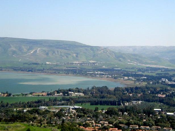
A Boat Ride on the Sea of Galilee
As you head out to sail on the Sea of Galilee from the pier Tiberias, Genesaret, Capernaum National Park or Ein Gev, the spray refreshes you, gulls wheel overhead, and other “sailors” call out greetings. But the highlight is when your captain cuts the motor and you’re surrounded by landscapes sacred for thousands of years. In your wooden boat, resembling ancient ones, you feel you’ve gone back to a time when people depended on wind and waves for their livelihood and their miracles.
Here, Yeshua walked on the water (John 6:19-21), calmed a storm (Matt. 8:23-26), and showed the disciples miraculous catches of fish (Luke 5:1-8; John 21:1-6). Many Jewish visitors also take the lake trip, heading out to where tradition says Miriam the Prophetess caused a miraculous spring to appear.
Ask your travel planner or hotel staff to make your boat-ride reservation during your Galilee stay
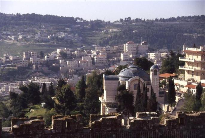
St. Peter in Gallicantu
Site of a Church since at least the 6th century, this spot is believed to be the location of Caiaphas' house, the setting for Peter's denial of his connection with Yeshua on the night of his trial and the shedding of his self-recriminatory tears.
Matthew Chapter 26
57 Then those who had seized Yeshua led him to Caiaphas the high priest, where the scribes and the elders had gathered. 58 But Peter followed him at a distance, as far as the courtyard of the high priest, and going inside he sat with the guards to see the end. 59 Now the chief priests and the whole council sought false testimony against Yeshua that they might put him to death, 60 but they found none, though many false witnesses came forward. At last two came forward 61 and said, “This fellow said, ‘I am able to destroy the temple of Yahweh, and to build it in three days.’” 62 And the high priest stood up and said, “Have you no answer to make? What is it that these men testify against you?” 63 But Yeshua was silent. And the high priest said to him, “I adjure you by the living Yahweh, tell us if you are the Christ, the Son of Yahweh.” 64 Yeshua said to him, “You have said so. But I tell you, hereafter you will see the Son of man seated at the right hand of Power, and coming on the clouds of heaven.” 65 Then the high priest tore his robes, and said, “He has uttered blasphemy. Why do we still need witnesses? You have now heard his blasphemy. 66 What is your judgment?” They answered, “He deserves death.” 67 Then they spat in his face, and struck him; and some slapped him, 68 saying, “Prophesy to us, you Christ! Who is it that struck you?”
69 Now Peter was sitting outside in the courtyard. And a maid came up to him, and said, “You also were with Yeshua the Galilean.” 70 But he denied it before them all, saying, “I do not know what you mean.” 71 And when he went out to the porch, another maid saw him, and she said to the bystanders, “This man was with Yeshua of Nazareth.” 72 And again he denied it with an oath, “I do not know the man.” 73 After a little while the bystanders came up and said to Peter, “Certainly you are also one of them, for your accent betrays you.” 74 Then he began to invoke a curse on himself and to swear, “I do not know the man.” And immediately the cock crowed. 75 And Peter remembered the saying of Yeshua, “Before the cock crows, you will deny me three times.” And he went out and wept bitterly.
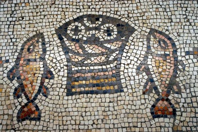
Tabha
The quiet cove of Tabha on the northern shore of the Sea of Galilee is the scene of many Gospel stories, including the Multiplication of Loaves and Fishes.
Early Christians marked the site of this miracle (Matt. 14:15-21; Mark 6:35-44; John 6:1-14) with a church containing magnificent mosaics. The small loaves and fishes mosaic, marking the place where Yeshua uttered a blessing over the bread, has become a well-loved symbol of this place and the miracle.
Visitors love to take a walk along the Tabha-Capernaum promenade, built by the Tourism Ministry, to another part of the Tabha cove and the Church of Peter’s Primacy. This is the traditional site of the events of John 21 after the resurrection – Yeshua cooking breakfast for the disciples, the miraculous catch of fish and Peter’s reconciliation. Tabha comes from a Greek word meaning “seven springs.” One, the Spring of Job, surges into the lake a short walk eastward along the promenade
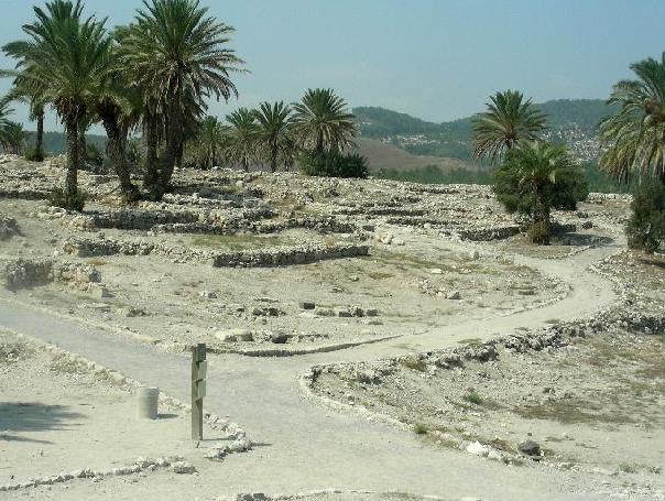
Tel Megiddo
When you stand atop the ancient mound of Megiddo, with the remnants of 25 civilizations beneath your feet, each hill and valley you see tells a biblical tale. Every army that ever crossed this land clashed in its shadow. No wonder the Book of Revelation set the great battle of the End of Days against this backdrop, and called this place Armageddon.
Megiddo stands at the very hub of history. It was a central stop on the greatest trading route of ancient world, which crossed the land bridge of Canaan to link the far reaches of the Fertile Crescent – Egypt in the south and Mesopotamia in the north. Joshua (Joshua 12:21), King Solomon (I Kings 9:15) and the ill-fated King Josiah (2 Kings 23:30) all beheld its walls, which finally fell to the invading Assyrians.
When you come to Tel Megiddo, now Megiddo National Park and a World Heritage Site, you can’t help but sense the power of the massive gates that held the Egyptian army at bay for months, and the gates above them attributed to King Solomon. You will look down on a round altar where Canaanite sacrifices were carried out, and understand what the Bible means when it talks about “high places” where the Canaanites – and the Israelites – sacrificed to idols (2 Kings 23:19). The remains of the city the Assyrians built here some 2700 years ago are here as well, now scattered across the landscape.
Another Megiddo highlight is the descent down 180 steps into the shaft and tunnel, hewn in an amazing engineering feat to channel spring water into the city in the eighth century BCE, during the reign of King Ahab.
Though no town existed here in Yeshua’ day, a surprising illustration of the nativity story has become a popular photo op: stone feeding troughs in stables from the days of the Israelite kings are precisely the type of manger in which the baby Yeshua was laid (Luke 2:7).
Right down the road from Megiddo, an amazing discovery was made in November 2005 in excavations prior to the expansion of a prison, of all things: a mosaic floor bearing three inscriptions in Greek. Among them is one honoring a woman named Akeptos, “lover of Yahweh, who contributed the table to Yahweh, Yeshua Christ as a memorial.” Archaeologists say that because the inscription mentions a table (and not an altar, a later custom) the Eucharist at the time must have still been conducted around a table, the way the first Christians did it. That may make this building unique in the Christian world, and we look forward to this site’s renovation, so Christian visitors can once again worship at what might be the oldest church ever found.
But nothing beats standing at the top of Tel Megiddo to take in the inspiring view: Mount Carmel to the west, Mount Gilboa to the east, Samaria to the south and, to the north, just across the valley – Nazareth. What better place to pray over and ponder this incomparable rendezvous with past and future.
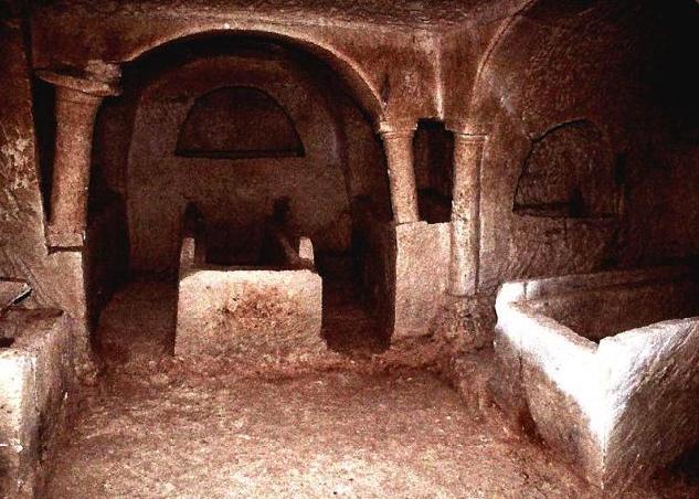
Tel Mareshah
Beneath the white chalk hillocks of the coastal plain hides an interconnecting system of caves that served the residents of Mareshah for hundreds of years. This community, which assumed a gentile character after the destruction of the Biblical Mareshah, was home to the Sidonians and Edomites. Its heyday was in the Hellenist Period, during the 4th-2nd centuries B.C.E., and it began its decline when the Hasmonean King Yohanan (John) Hyrcanus rose to power, and forcefully converted Mereshah’s residents to Judaism at the end of the 2nd century B.C.E.
Visitors can see man-made burial caves, caves that were used for raising pigeons or producing olive oil, and a network of underground caverns used as storerooms and water cisterns.

Timna Park
The geological wonderland of Timna Park is one of the biggest attractions in southern Israel. Only 17 miles north of Eilat, a visit to Timna is a great way to break your drive to Israel’s Red Sea Riviera. On a shorter stay you can see the highlights and enjoy the air-conditioned multi-media presentation, while on a longer foray you can also chose from several hiking routes, each with its own special appeal. Among the attractions, the windows of Timna’s restaurant frame what at first you’ll think must be a desert mirage – a lake! Use of a paddleboat is even included in your entrance ticket, as is the fun of filling a bottle with the multicolored sand for which the region is famous.
The star of Timna Park is Solomon’s Pillars, towering sandstone columns so perfectly formed that you might really think they were a gargantuan public works project initiated by the biblical king for whom they are named. But of course, they, like all the other formations in the 23-square-mile park, are nature’s handiwork. So are stripes of magma frozen in geological time in the cliffs, and the sandstone, in its soft palette of pastels, shaped by wind and water into strange shapes like “the mushroom” and “the sphinx.”
One of the shorter hiking routes takes you right through Solomon’s Pillars to behold the image of the Egyptian goddess Hathor carved into the stone, and to her ancient shrine at the foot of the cliffs of the other side. This imposing Lady of the Rock was the patroness of miners, as you’ll discover at the exciting multimedia presentation, “Mines of Time,” where the pharaohs, kings, queens and quarriers, who knew this region millennia ago, come alive. After enjoying the presentation, you’ll be able to decipher the mystery of the 8,000 or so stone circles discovered in the park: they once led to shafts that were the first copper mines in the world (one of which you can explore). Copper mining was renewed for a time in the early days of Israel as a livelihood for the newborn city of Eilat; a byproduct is the beautiful teal-to-turquoise rock known as Eilat stone, which is an Israeli jewelry trademark.
From October to April, groups can enjoy rappelling, archery, and a zip-line at the park. During the summer months, regular park hours are extended to offer sunset tours, and you can attend an evening show at the illuminated cliffs. Timna Park can also be an imaginative venue for your special family celebration in Israel.
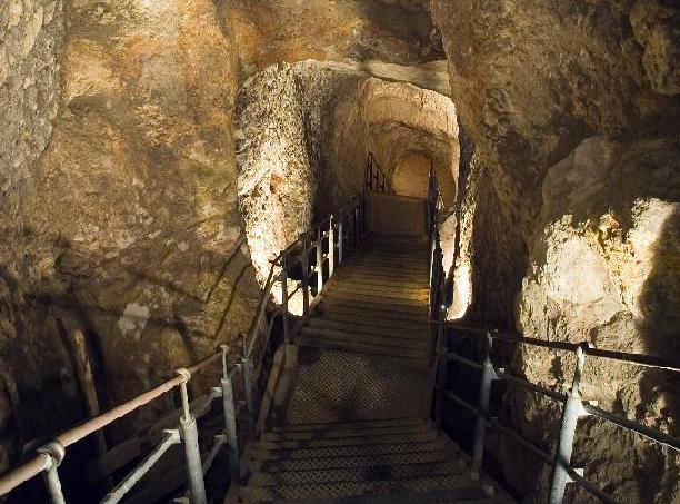
Warren’s Shaft
Warren’s Shaft is the name of the underground waterworks system dating from the age of the kings of Judea. The entrance crosses a tunnel descending to a vertical shaft, whose end lies on the level of the Gihon spring.
Warren’s shaft is possibly the Jebusite water system that David used to conquer to city, but it is thought that the inhabitants of the lnd at that time lacked the technology to build such a work. The shaft enabled people to draw water from the Gihon spring without leaving the city, important in times of war, and was rediscovered in the last century by a British officer, Captain Warren.
2 Samuel 5
6 And the king and his men went to Jerusalem against the Jebusites, the inhabitants of the land, who said to David, “You will not come in here, but the blind and the lame will ward you off”—thinking, “David cannot come in here.” 7 Nevertheless David took the stronghold of Zion, that is, the city of David. 8 And David said on that day, “Whoever would smite the Jebusites, let him get up the water shaft to attack the lame and the blind, who are hated by David’s soul.” Therefore it is said, “The blind and the lame shall not come into the house.” 9 And David dwelt in the stronghold, and called it the city of David. And David built the city round about from the Millo inward. 10 And David became greater and greater, for the Lord, the God of hosts, was with him.
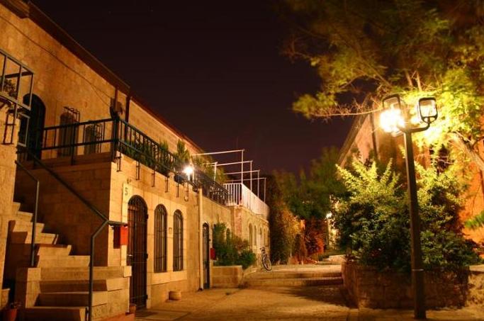
The Yemin Moshe neighborhood, named after the philanthropist Sir Moses Montefiore, is built on narrow stone lanes with rural houses. The old flour mill now houses an exhibition on the philanthropist's activity. Montefiore's reconstructed carriage stands in a display-window next to the flour mill.
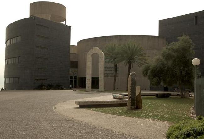
Yigal Allon Museum at Kibbutz Ginosar
|